Any Activity
Chief Mountain
360 Degree Views of
Clear Creek County
Featured Route
This steep but short uphill hike will take you through a spruce and fir forest before reaching an alpine tundra with magnificent 360 degree views from the summit. Few hikes pack this much variety and beauty into a relatively small package. You’ll be able to look across the entire Bear Creek Basin and view summits such as Mount Evans, Mount Goliath, Rogers Peak and Roslin Peak.
This route is often traversable in winter with snowshoes, so be sure to check conditions and plan ahead. Never attempt the climb if avalanche conditions might exist.
 Hiking
- Out & Back
- Wildflowers
- Scenic
 Wildlife
 Dog Friendly
- Kid-Friendly
Photos


Elevation Profile
Loading…
Timeline
1
The trailhead is small and on the north side of the road. This route can be quite popular, so be sure to arrive early for parking. Cross the road to the southeast and look for an opening into the forest.
Start Hiking
For 1.4mi
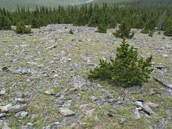
Expect a steep but short climb along several switchbacks through both spruce and fir trees for the first mile, after which it opens up to a rocky alpine tundra above the treeline. Be sure to stay on the trail, as this environment is more fragile than it may look.
2
Well above a clean treeline, you have unrestricted views in every direction and can truly appreciate what makes this part of Colorado special. Some of the notable sights include Mount Evans, Mount Goliath, Rogers Peak and Roslin Peak.
Trip Reports


